Archives County by County
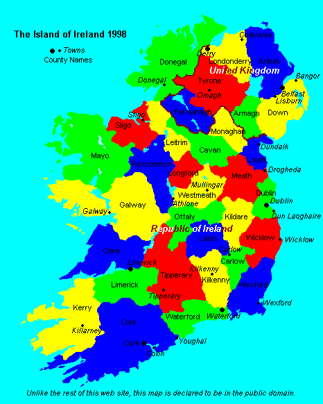
Ireland was divided up into counties by the English crown around 400 years ago. Since then, the counties have remained largely unchanged. In Northern Ireland they survive merely as curiosities - not having any actual purpose any more. In the Republic of Ireland, however, these historic divisions are still used as the basis of local government. The map below shows the 32 counties in the island of Ireland (26 in the Republic of Ireland and 6 in Northern Ireland) as well as some of the major towns (in italics).
The Four Provinces
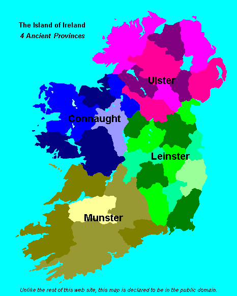
In ancient times, Ireland was divided into provinces, each ruled by a King. These provinces were dynamic and their borders changed all the time. Today,when Irish talk about the provinces of Ireland, they mean Leinster, Ulster,Munster and Connaught. However, historically there were more than 4 provinces: others included Breifne [between Ulster and Connaught], Oriel [around county Armagh] and Meath [the northern half of Leinster]. The map below shows the 4 provinces of Ireland as they currently exist. The borders of these provinces coincide exactly with the county boundaries.
In ancient times, Ireland was divided into provinces, each ruled by a King. These provinces were dynamic and their borders changed all the time. Today,when Irish talk about the provinces of Ireland, they mean Leinster, Ulster,Munster and Connaught. However, historically there were more than 4 provinces: others included Breifne [between Ulster and Connaught], Oriel [around county Armagh] and Meath [the northern half of Leinster]. The map below shows the 4 provinces of Ireland as they currently exist. The borders of these provinces coincide exactly with the county boundaries.
At present there are 37 authorities, County Councils, City Councils, Bourough Councils and Town Councils running 30 Fire Brigades with 220 Fire Stations. The Fire Brigade Archives on this site are laid out County by County.
Jan 2012.
Jan 2012.
